"My Encounter with the Topography of Western Jordan" by Charlie Perricelli
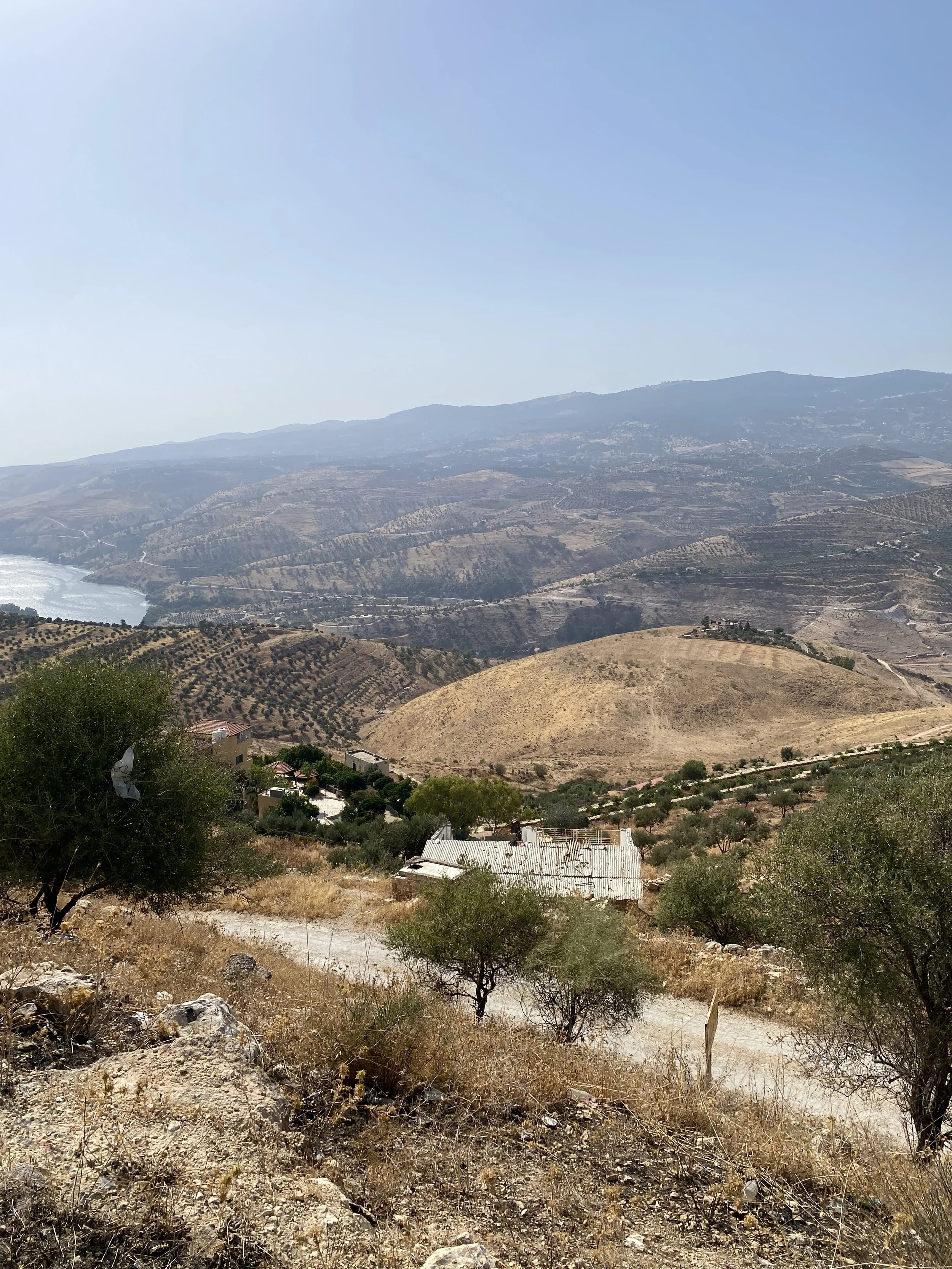
Banner image: On a road trip, we stopped on the side of the road to get a good view of the Zarqa River which forms into a lake due to the King Talal Dam north of Amman. Photo credit: Perricelli, 2024.
Coming to Jordan, I was expecting to be living in a dry plains, desert, or plateau environment resembling what most of Jordan looks like. Frankly, I didn’t do my research! I quickly found out Amman and its nearby cities are not in such an environment. Hopefully, if you ever plan on coming to Jordan, you read this blog post and are more prepared for the hills and jagged cliffs that characterize western Jordan than I.

In a way, I am glad I didn't really do deep research beforehand. I tried to come in with an open mind and without preconceived notions of what I should see during my time in Jordan. It gave me the opportunity to be amazed at some of the natural features of this beautiful landscape that I get to experience.
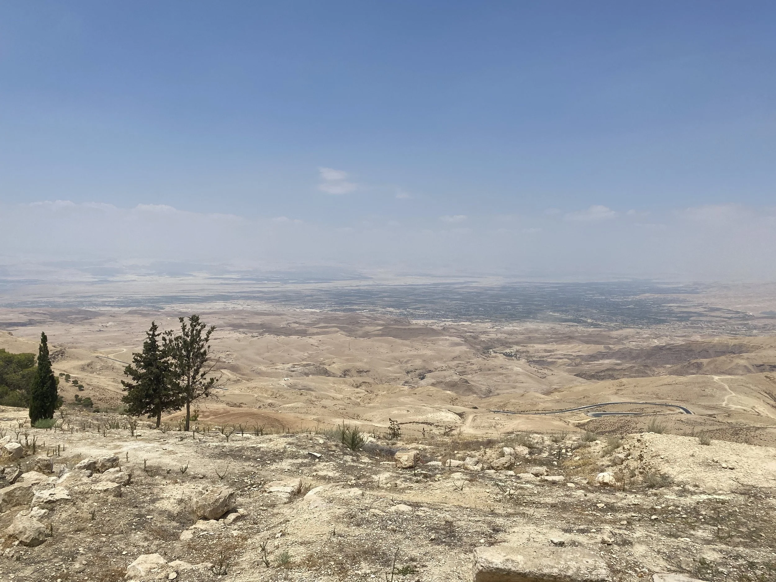
The most striking feature to me by far was the Jordan valley. The view from Mt. Nebo affords a perfect vision of the valley, including some of Jordan’s main agricultural areas and even some cities in the West Bank of Palestine. We experienced this view on a trip to the Dead Sea, and as the lowest point on Earth, the trip to the Dead Sea involved a dramatic descent into the Jordan valley. The results of this are dramatic hills, cliffs, and valleys to be observed during the trip down from the highlands where Amman is nestled. I was struck by thoughts imagining the ancient peoples who used to migrate across this territory, and the difficulties they must have encountered scrambling over the rocks and descending the slopes to the more fertile lands below.
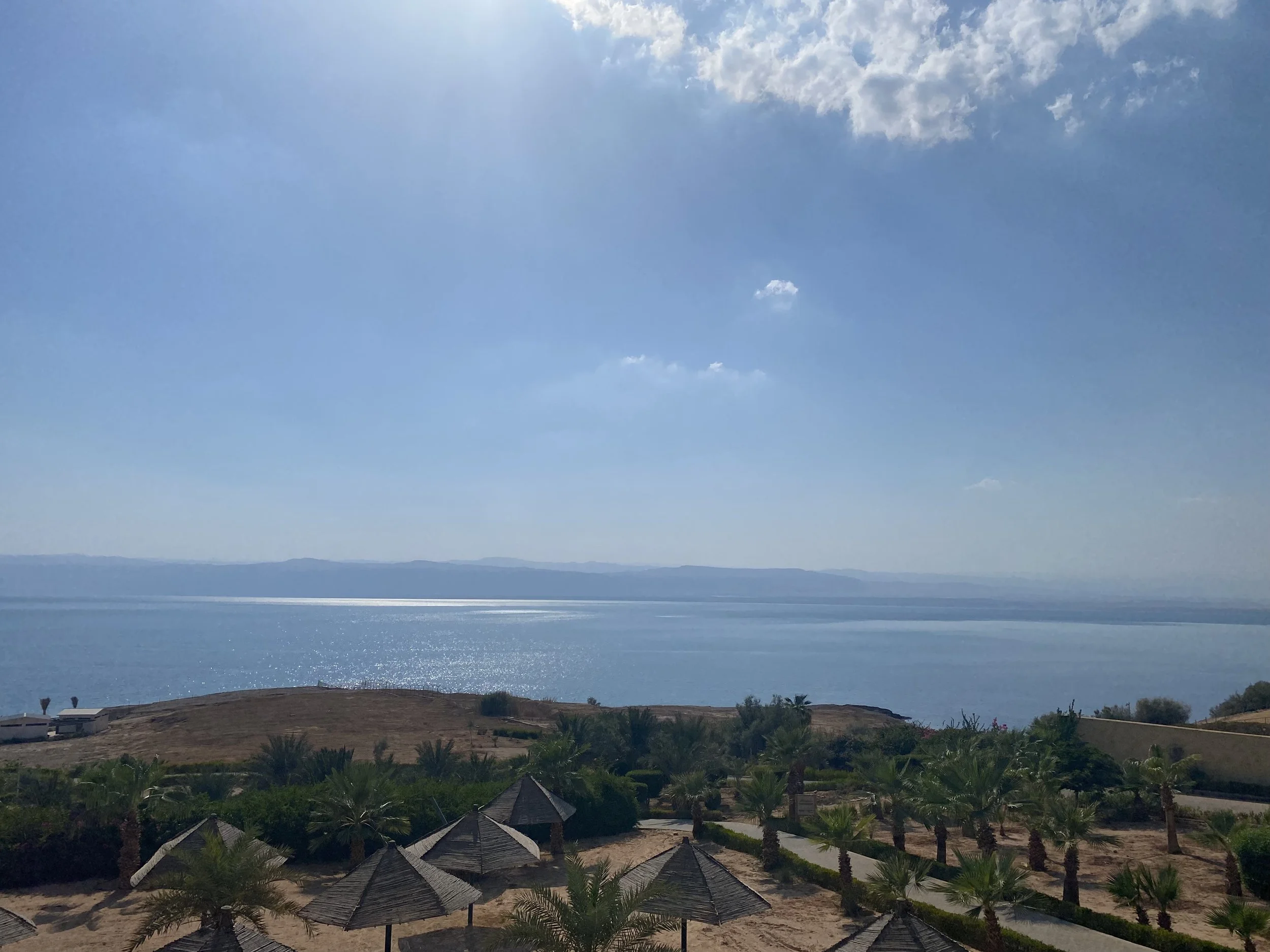
During our excursion to the Dead Sea, we stayed in a beautiful resort with views like these. It was super cool to be at the lowest place on Earth!
During our trip to the Dead Sea we got to experience the spa-like features of the extremely salty water and visit the historical site of the baptism of the religious figure Jesus along the river Jordan. Because of its location hundreds of feet below sea level, the temperature was extremely hot, but somehow the area is successful as an agricultural stronghold, mostly due to irrigation from the Jordan river. While in the valley I was constantly struck by the mountains looming on both sides. That sight was actually what gave me the idea to write this blog post. Whatever I was expecting to see, these massive features were not it.
The altitude difference this valley and these hills provide is so dramatic that as we were descending them to the valley and ascending them on the way back to Amman, my friend Elijah and I heard the crinkling of empty plastic water bottles in the back, which was a result of the dramatic changes in air pressure that we were experiencing with the altitude change.
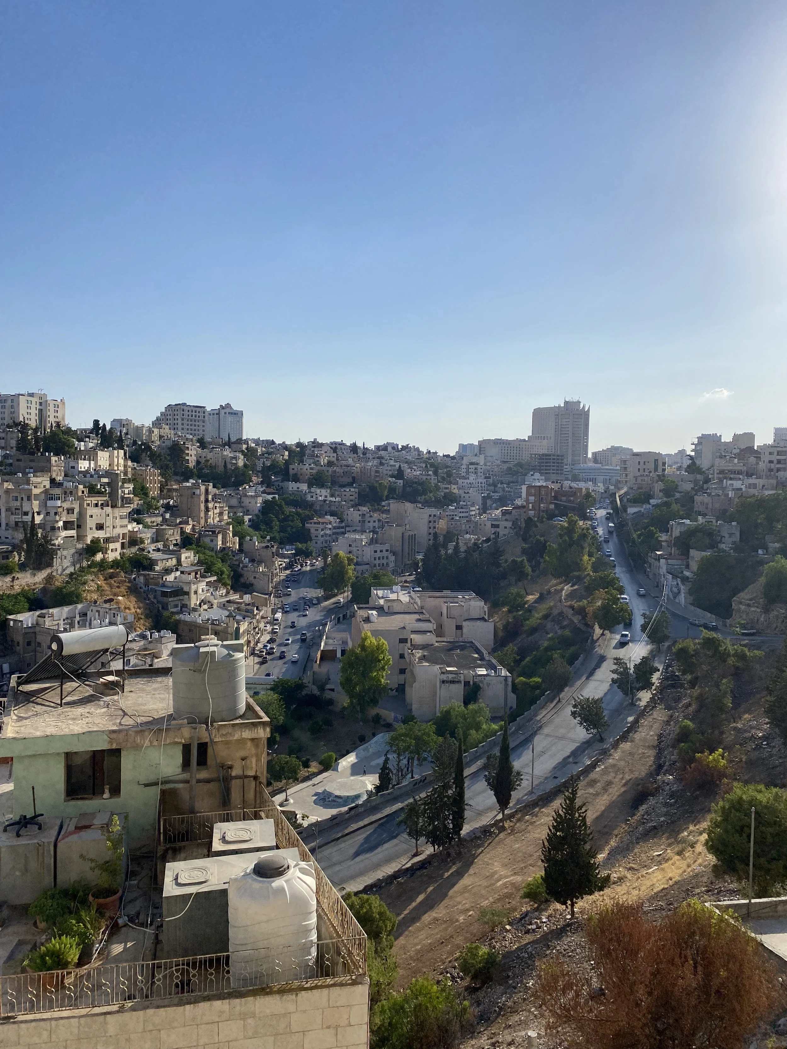
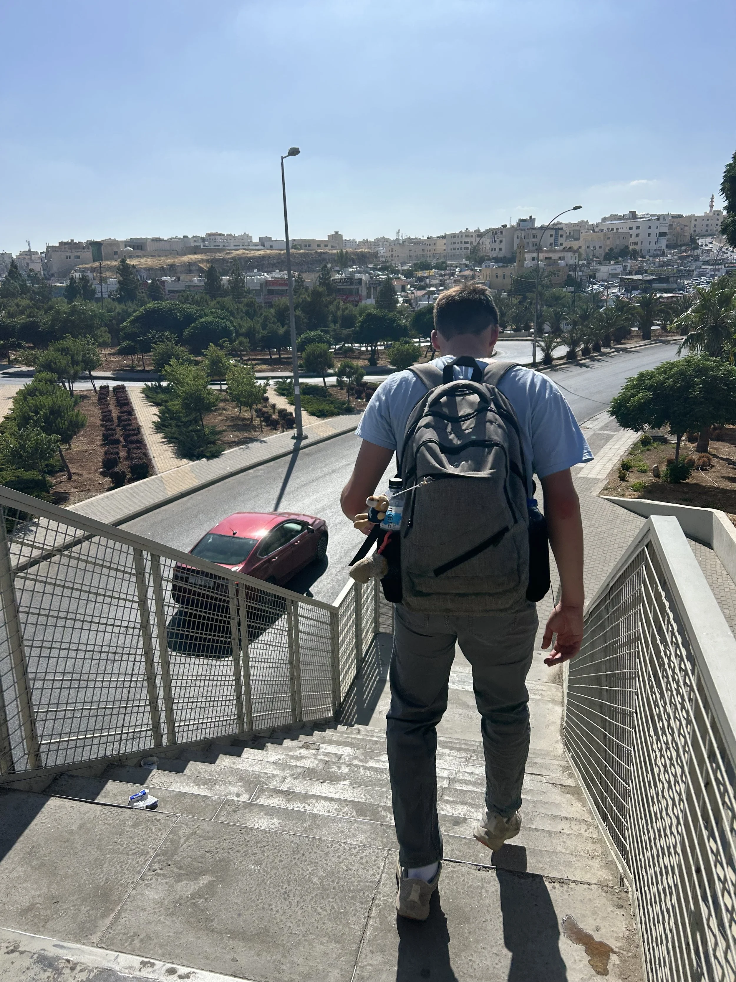
As we returned to Amman, I was able to appreciate the hills that characterize its iconic views. The same hills that gave Amman strategic importance and natural defenses during ancient times now provide for terrace farming and rows of homes, each with views overlooking different parts of the city. Amman is built on seven hills/mountains (جبال) with valleys (وديان) running through the space between. On hot days, walking up and down these hills is great exercise and a nice shift from sitting in class. I always make sure to fill up my water before I leave Amideast to make sure I have enough for the walk back to my house from the bus.
Hopefully you now have some idea of the beauty of western Jordan! It truly amazes me every day and I am very surprised that there are not more people from around the world that come to visit.
All photos - Photo credit: Perricelli, 2024.
Charlie Perricelli is a student at Villanova University and is studying abroad on the Amideast Intensive Arabic Program in Jordan this Summer, 2024.